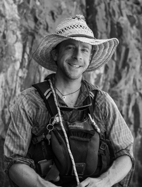
I am a watershed scientist, skier, mountainbiker, and river-lover. Central Colorado is my current home but I like to range as far and wide as I can.
This site is a personal sandbox to practice and showcase my interests, work projects, and coding progression for data science and web development. It's a work in progress; thanks for dropping in...
About me:
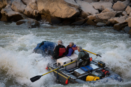
I began running whitewater rivers in West Virginia as a teenager, and have since professionally guided dozens of river segments in 4 states and abroad in India. Most of my river time is on personal trips these days, but I still make an appearance at Lakota Guides a few days each season.
At the University of Virginia I completed degrees in Environmental Science and Economics. Later I finished a Masters at Northern Arizona University. My education has focused on hydrology, water quality, and environmental policy.
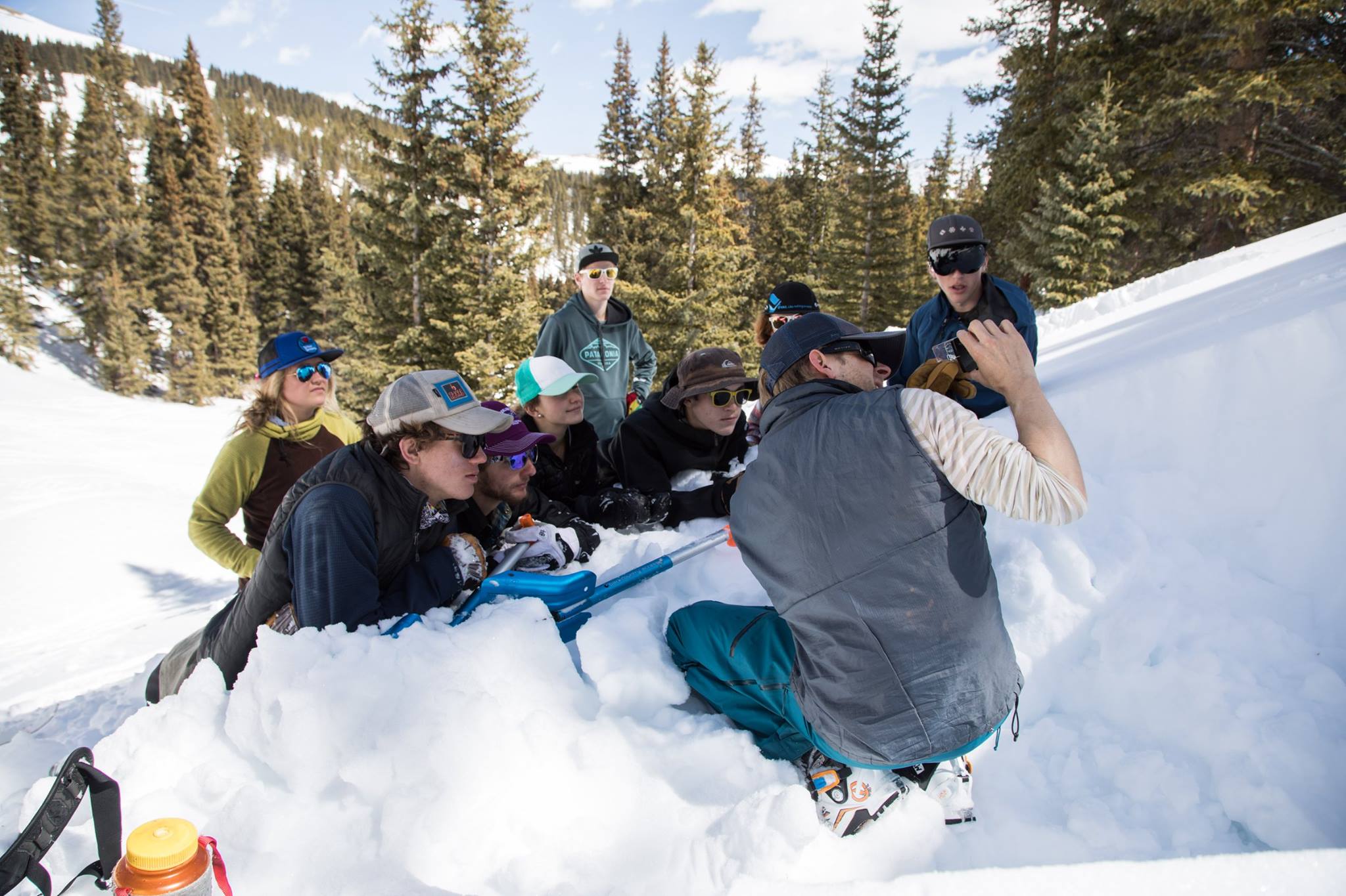
While river guiding, leading backcountry trips, ski patrolling, working as an EMT, and teaching environmental education and avalanche safety, I've learned a few things about teamwork and operating in challenging and adverse conditions.
At Lotic Hydrological I use science-based tools to help water resource decision makers manage our rivers in ways that balance and elevate both ecosystem and social values.
Water quality | Hydrology | Fluvial Geomorphology | Watershed Planning | GIS | Spatial Analysis | Data analysis | Data Visualization | Stream Ecology | Monitoring and Field Investigations | Water Policy | Environmental Policy | Science Communication GIS | Cartography
Summary
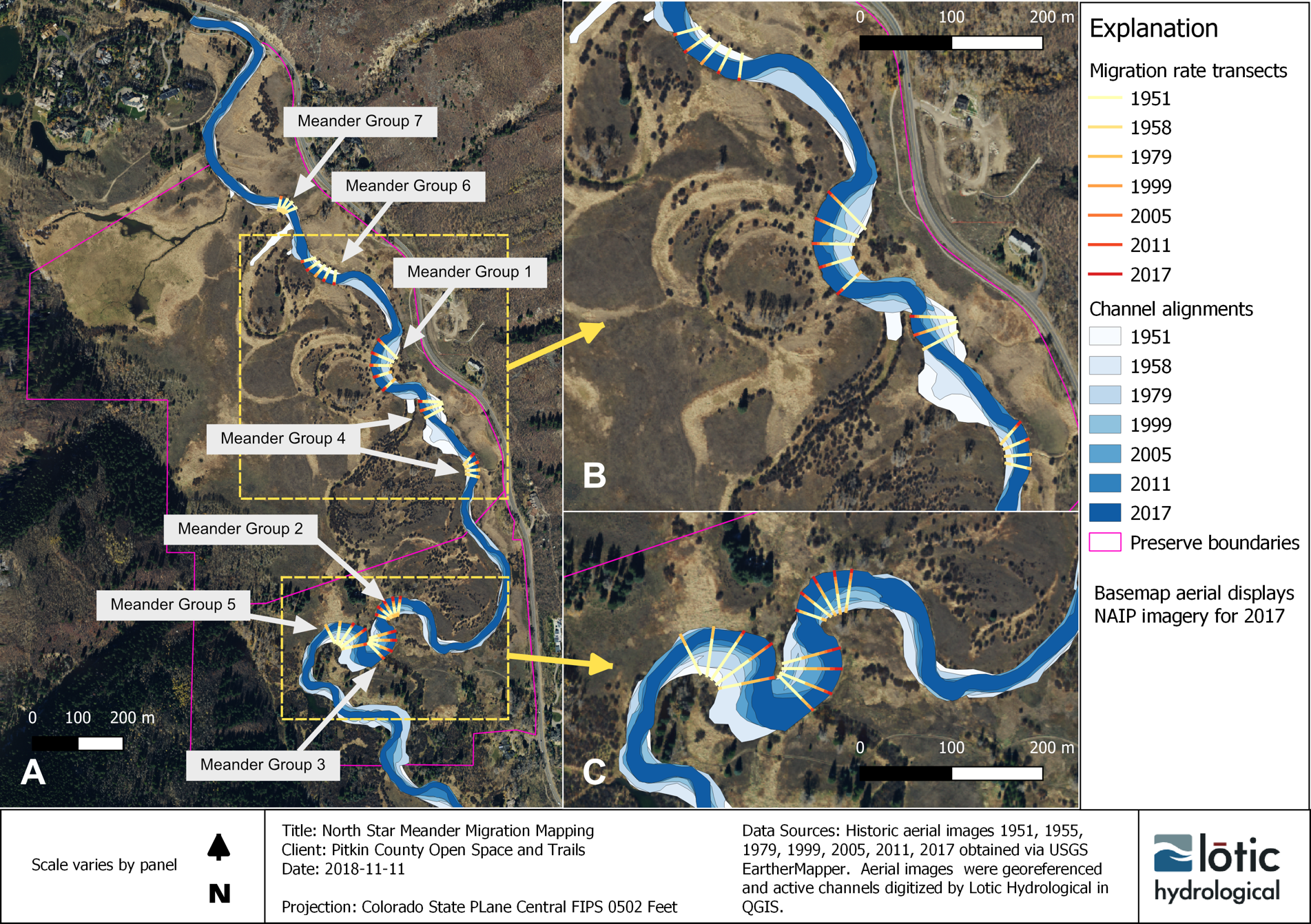
I have worked with Lotic Hydrological since 2013 providing technical expertise to conservation NGOs and local governments. Project types include watershed health assessments, stream restoration and environmental flows, water resource planning, creation and execution of environmental monitoring plans, Clean Water Act compliance, and environmental policy review. Recent work has featured the creation of interactive visual tools and maps used to distill and communicate complex scientific information for water resource decision makers and public.
I am proficient with various spatial analytical tools including multiple GIS systems (QGIS, Saga, WhiteboxGAT, ESRI) as well as R and Python programming for translating raw data into actionable information for decision-makers.
I am experienced in difficult field settings and have developed leadership, public speaking, and project management skills via years of outdoor guiding and instructional work. I'm working to increase my capabilities with interactive web-based data analysis and visualization tools for science communication.
I have served in numerous previous leadership and education roles overseeing adult youth and learning in both the academic and outdoor guiding setting. These include lead and assistant instructor roles in ecology, outdoor living skills, professional river guiding, and avalanche safety. My risk management proficiency in these roles is backed EMS experience on professional ski patrols and a municipal ambulance service.
Water quality and hydrologic data analysis, enviornmental statistics
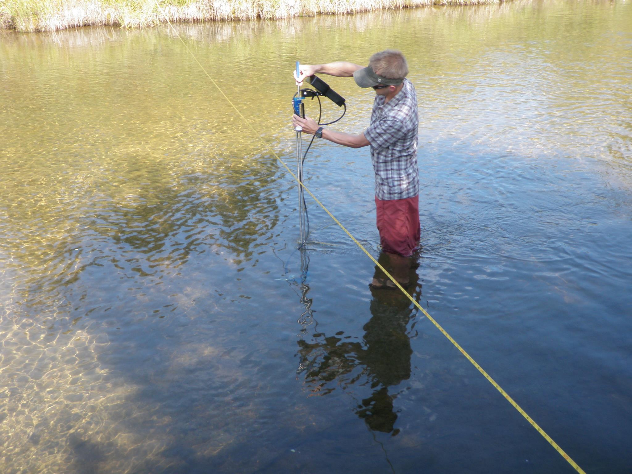
Geomorphic and hydrologic field investigations, GPS surveying and transects
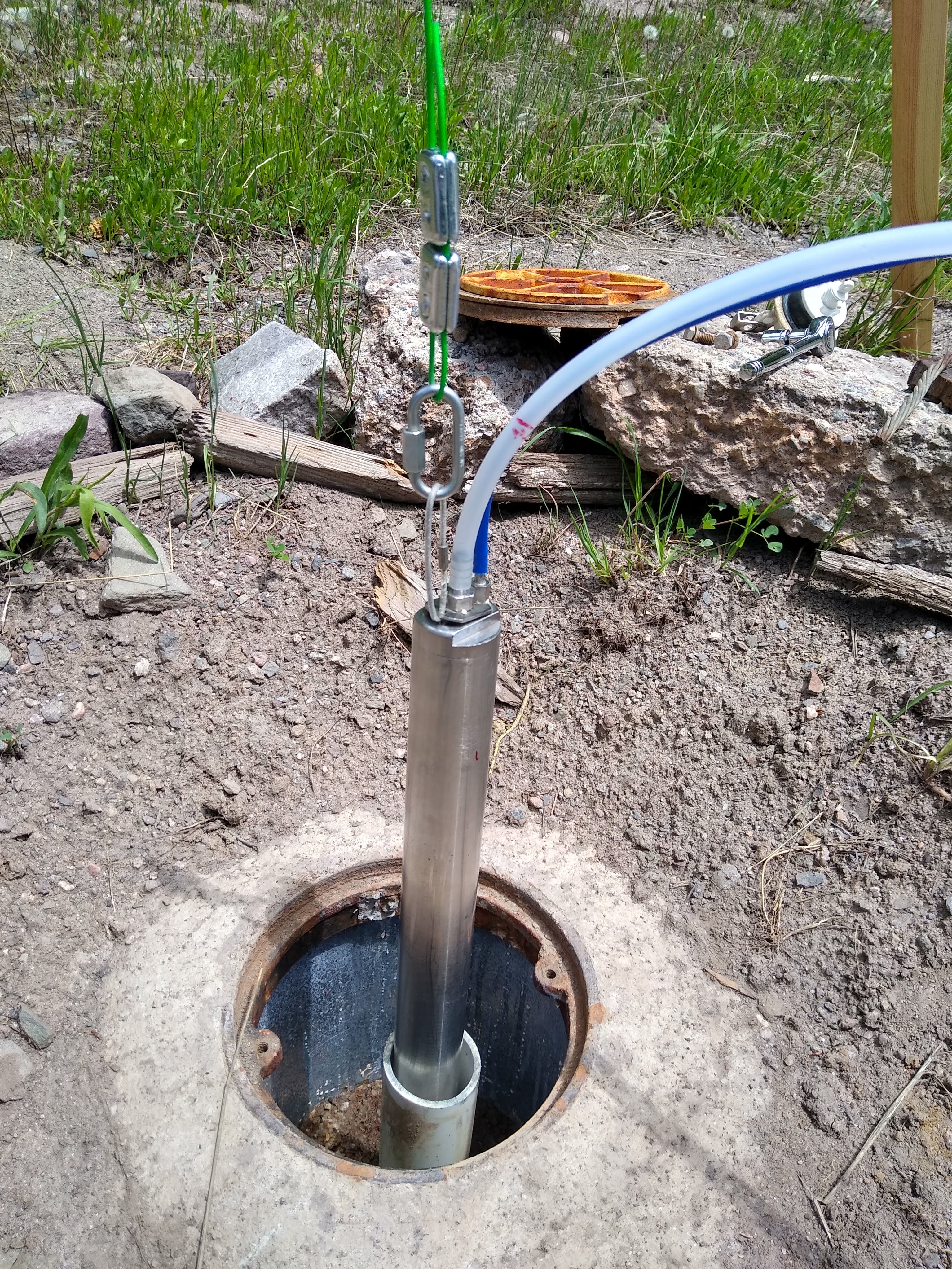
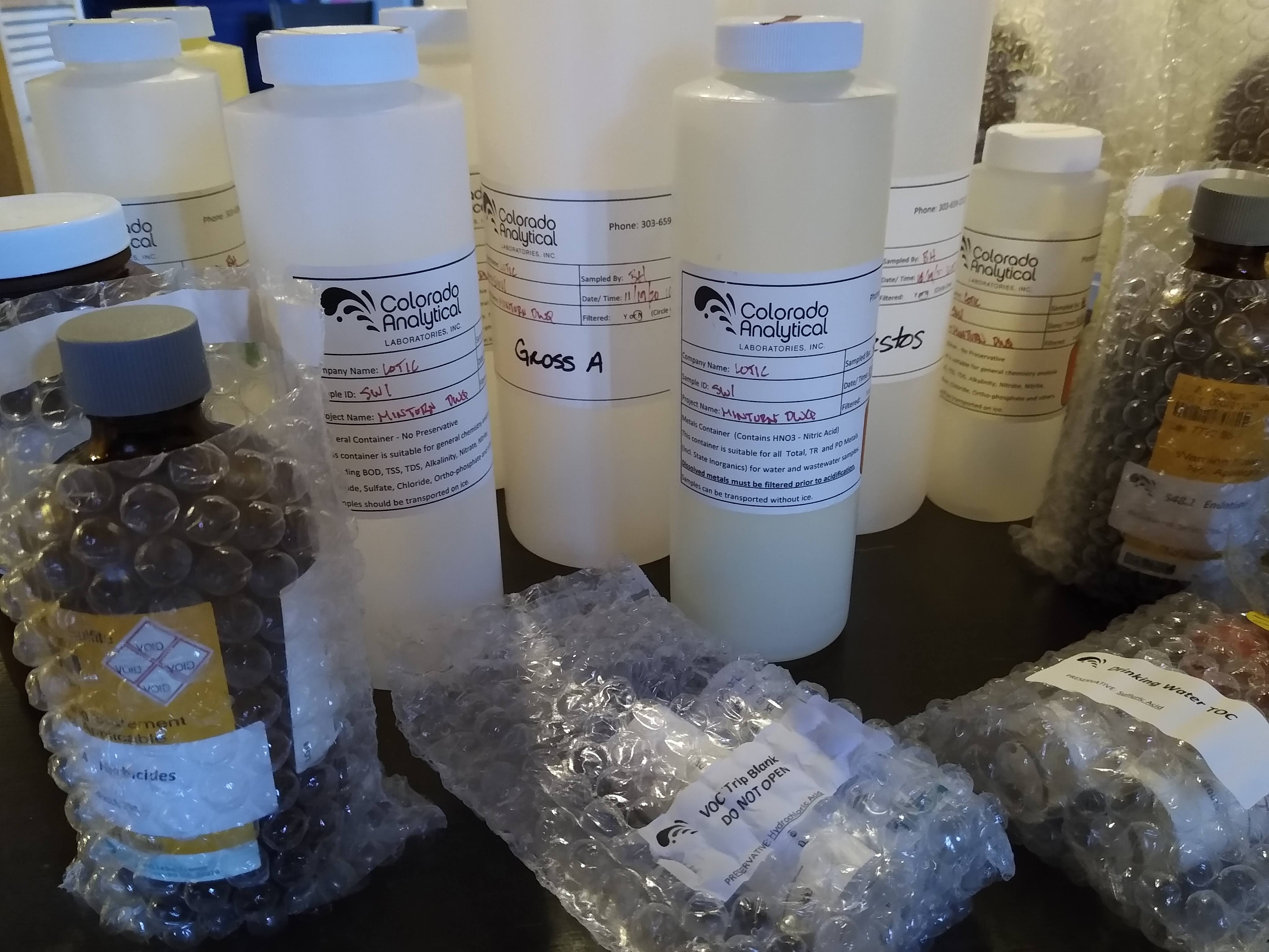
Discharge measurements, water sampling, data loggers, macroinvertebrate collection
Water policy; Clean Water Act, NEPA, CERCLA, state water policy and water rights
Technical writing and report preparation
Science communication; writing and graphics for non-technical audiences
Sampling and Anlaysis Plan (SAP) preparation and execution
Source Water Protection Planning
Planning and Zoning land use analysis
Public Outreach/Education Presentations and Speaking Engagements
Professional Development Courses and Continuing Education
Applied Environmental Statistics
Rosgen I Applied Fluvial Geomorphology
Colorado Fluvial Hazard Zone Mapping (FHZ)
Spatial Tools for the Analysis of Rivers/Spacial Streams Networks (STARS/SSN)
Colorado Functional Assessment of Wetlands (FACWet)
Colorado Stream Health Assessment (COSHAF)
Wetlands Delineation
Outdoor Guiding and Instruction Experience
Ski Patrol, Moonlight Basin MT and Beaver Creek CO
Backcountry Ski Guide, Chicago Ridge Snowcats CO, Paragon Guides
Avalanche Level I Instructor, American Institute for Avalanche Research and Education (AIARE)
Senior Guide, Guide Instructor, Operations Manager at various whitewater companies, WV/CO/NM/MT
Wilderness First Responder WFR | Emergency Medical Technician EMT-B | Outdoor Emergency Care OEC | Swiftwater Rescue Technician
BA, Environmental Sciences, University of Virgina
BA, Economics, University of Virgina
MS, Environmental Science and Policy, Northern Arizona Univeristy
Additional coursework in Snow Science, Soils, Ecology; Montana State University
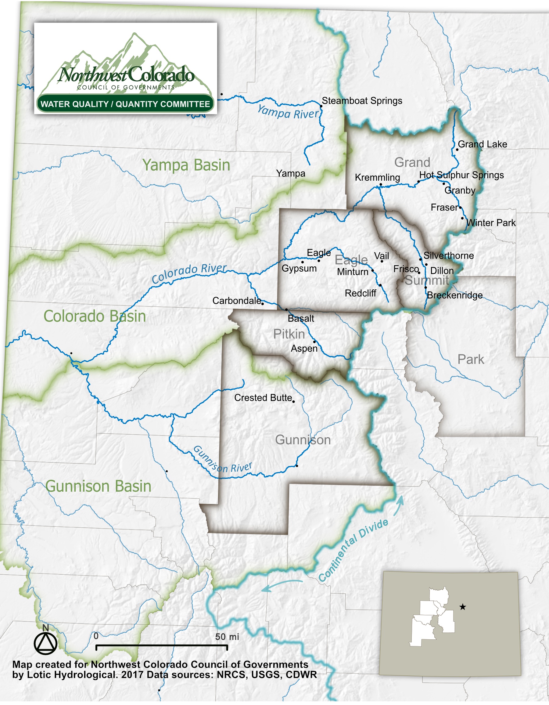
Integrated Water Management Plan, Middle Colorado Watershed Council
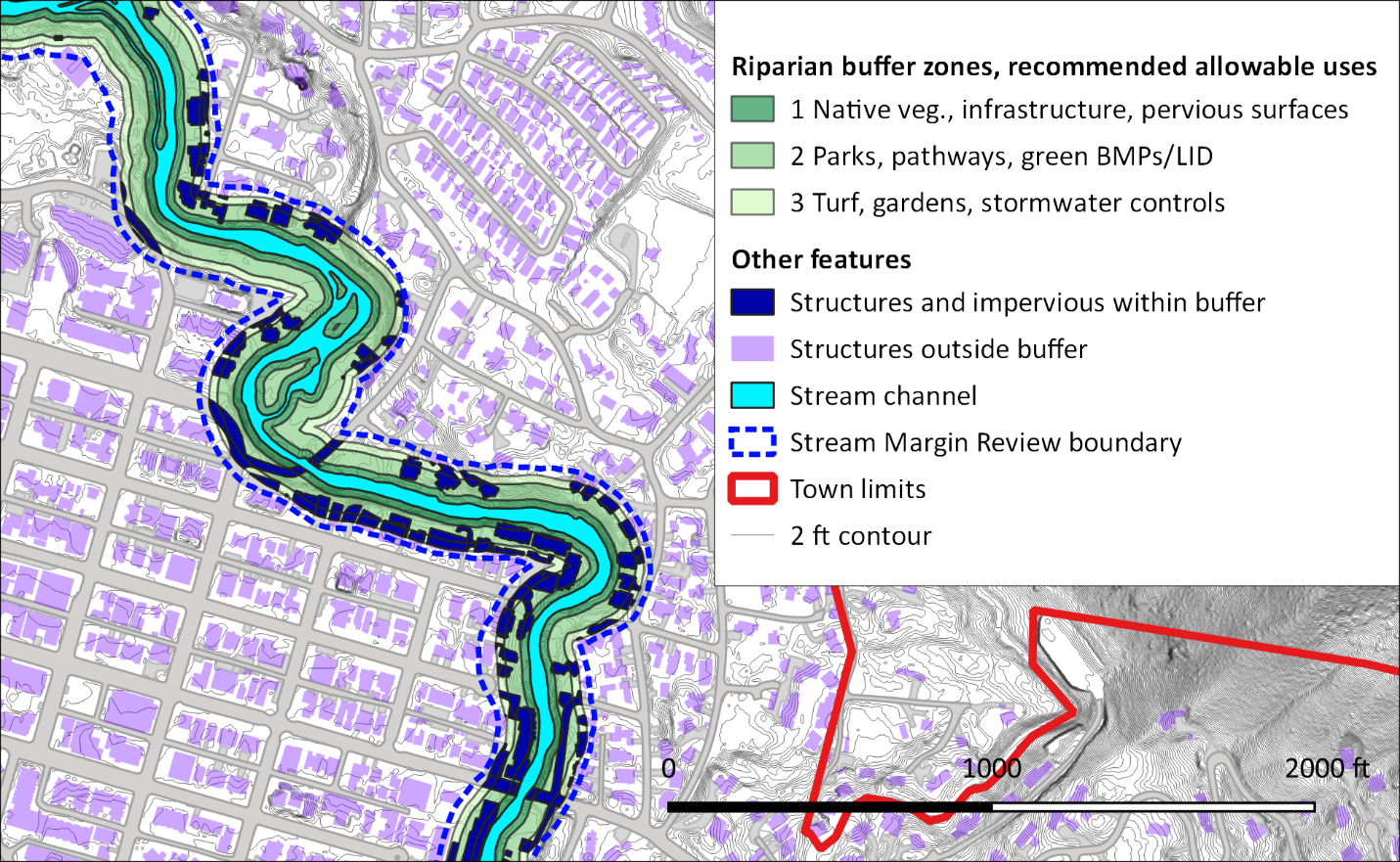
I conducted a variety of desk and field-based GIS investigations into non-consumptive water needs, riparian conditions, stream network connectivity, water quality health and trends for the purpose of information long term planning efforts of stakeholders to manage local streams for long term maintenance of non-consumptive water uses (environment and recreation) in the face of continued statewide population growth, climate risk and agriculture community needs.
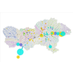
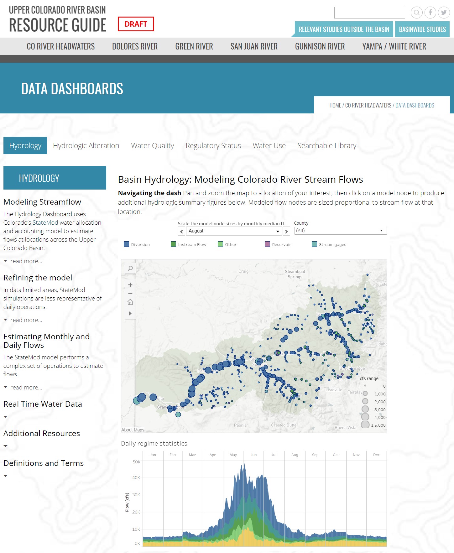
To help local decision makers, watershed groups, and educators communicate around issues using actual Colorado basin data and conditions, we created as series of public-facing interactive water resource dashboards displaying hydrology planning model outputs such as instream flows, consumptive water uses, and degree of hydrologic alteration. Other dashes featured water quality and regulatory inforation as well as a searchable watershed document library.
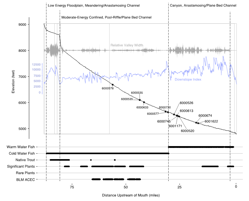
Upper Colorado River Wild and Scenic Stakeholder Group Temperature Assessment
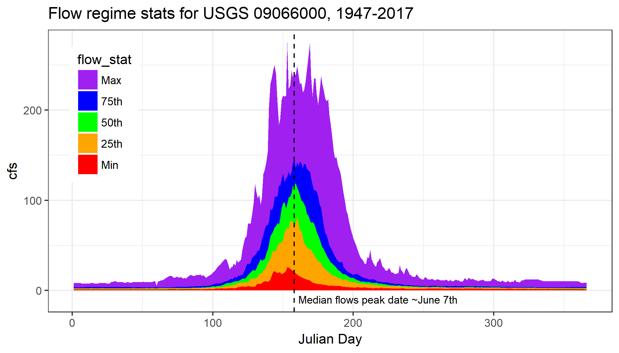
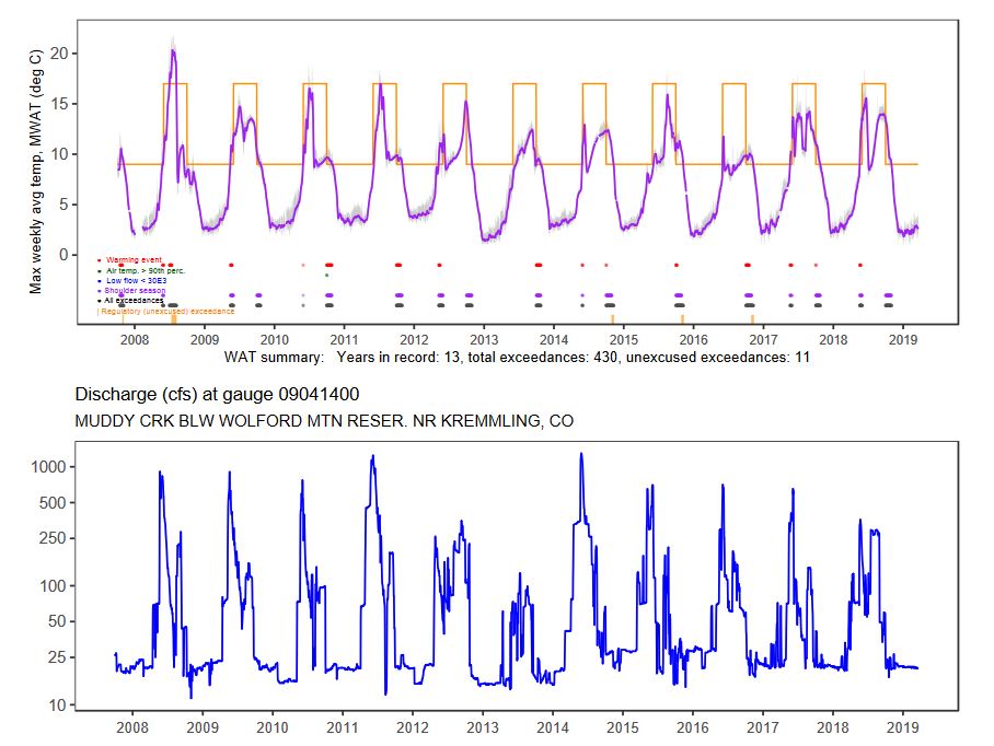
Maintenance of physical and chemical water quality for native and sport fisheries is a concern of the Upper Colorado Wild and Scenic Stakeholder Group. I performed an evaluation of continuous instream temperature data at 30+ sites for 10+ years of data in order to clarify spatial and temporal patterns of temperature regime concerns in the regional system. I created custom R code to clean and unify instream logger datasets, analyze results against state regulatory standards, and visually communicate site results in comparison to stream flows during the period of record.
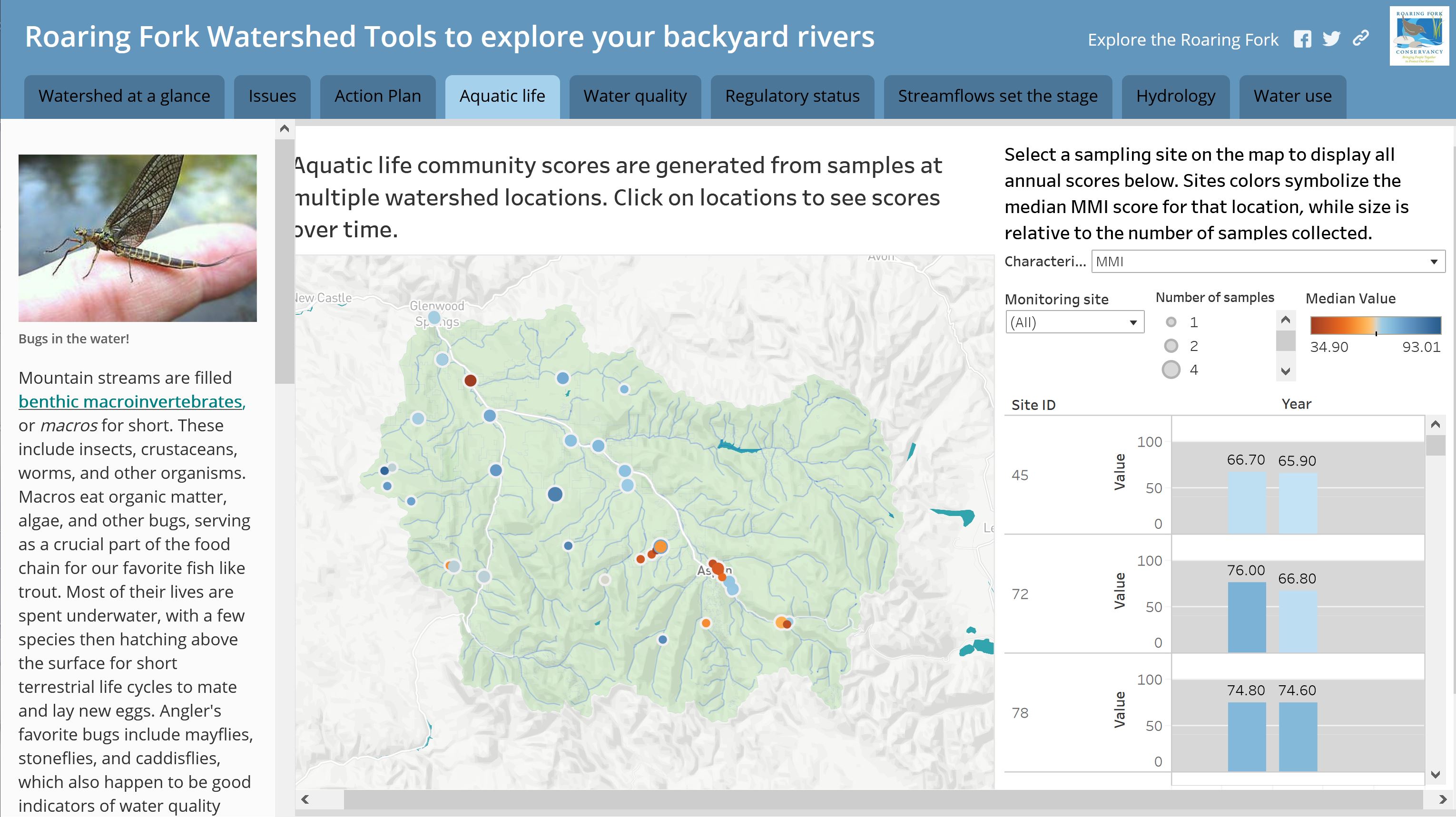
To help a regional river conservation group with education and outreach, I built an ESRI/ArcGIS Storymap for the Roaring Fork Watershed. Pulling in a variety of data sources on water quality, water quantity, and local policy issues, I created a curated tour through the basin using interactive maps and embedded Tableau data visualizations.
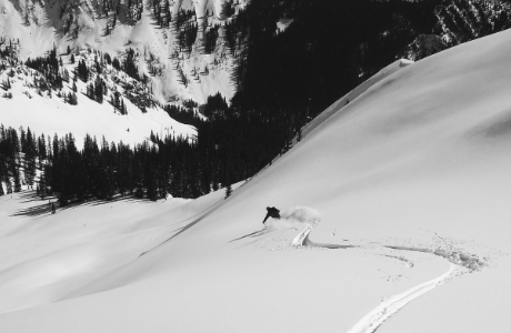
Touring in the Gore and Sawatch Rangers near my home in Vail is real real fun. Trips up to the Tetons are even better. My backcountry skiing page is under construction for later this season, I'm hoping to deploy a data dashboard for snow, weather, and avalanche conditions in my home range.
Mountain Biking
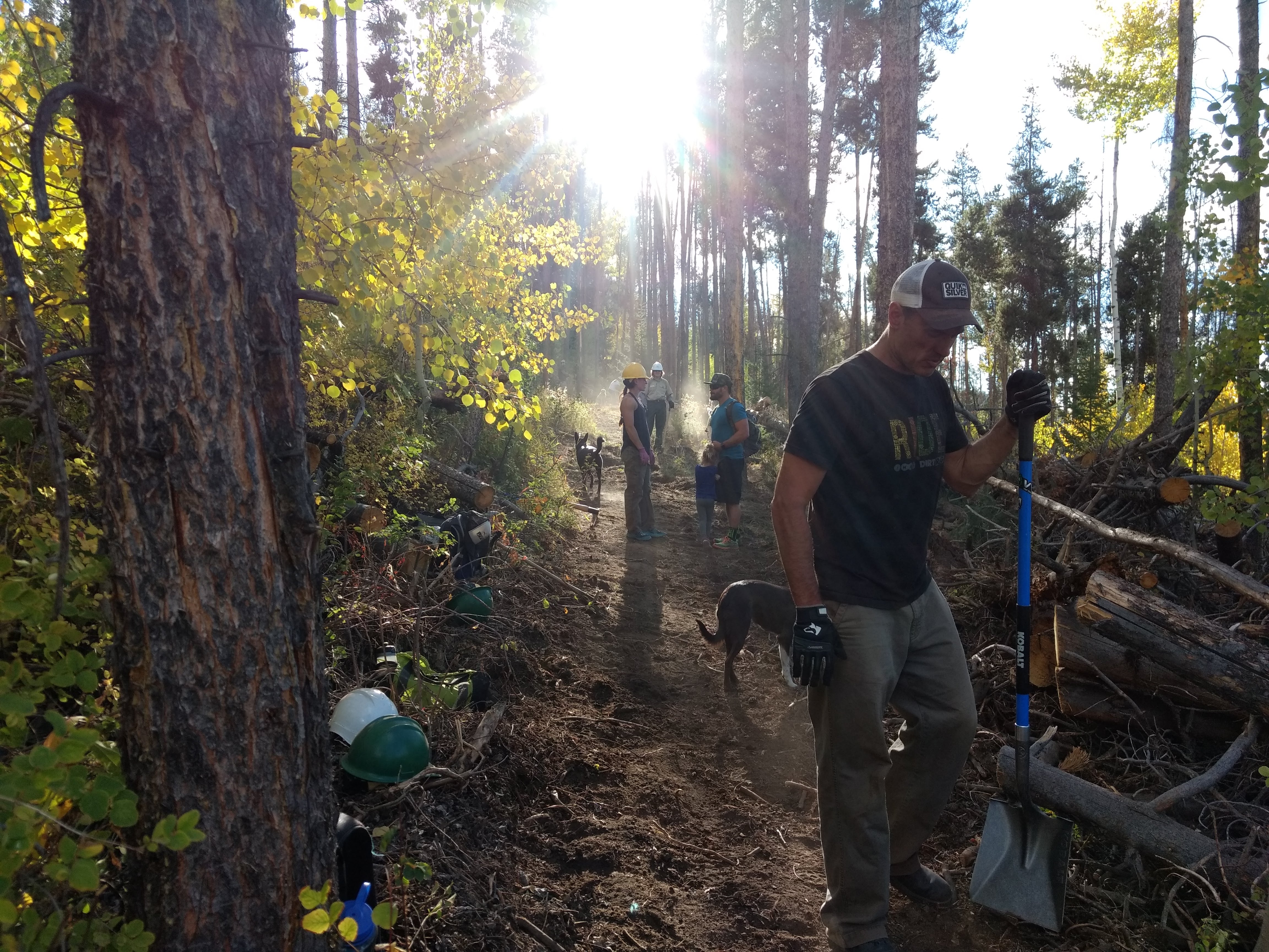
I started riding trails growing up in West Virginia and since then I've ridden all around the west. It's hard to go anywhere in Colorado without stumbling across a mind-blowing ride. I work on the board of the Vail Valley Mountain Trails Association (VVMTA) to plan, build, and maintain an amazing network right in the back yard.
Rafting and Kayaking
While I still push some commercial rubber now and then, my main interest at the moment is leveling-up my kayaking and getting out on as many classic western multi-days with friends and family each year as I can. I'll take Idaho rivers over the Grand if given a choice, but I'm not too picky...
Coding and Web Dev
What started out as a self-taught crash course in R to make some water quality graphics has turned into a rabbit hole of Python and HTML/CSS/Javacript. Building data visualizations and interactive deliverables has become one of our best tools at work for science communication on water issues with our clients.
Guitars and Ukes
It's awfully hard to have a complete beach camp scenario for a week on the Salmon River without some hackneyed amateur musical stylings with your frends. Apologies to everyone who pitched their tent too close to the fire circle over the years on our trips.